GIS Services We Offer:
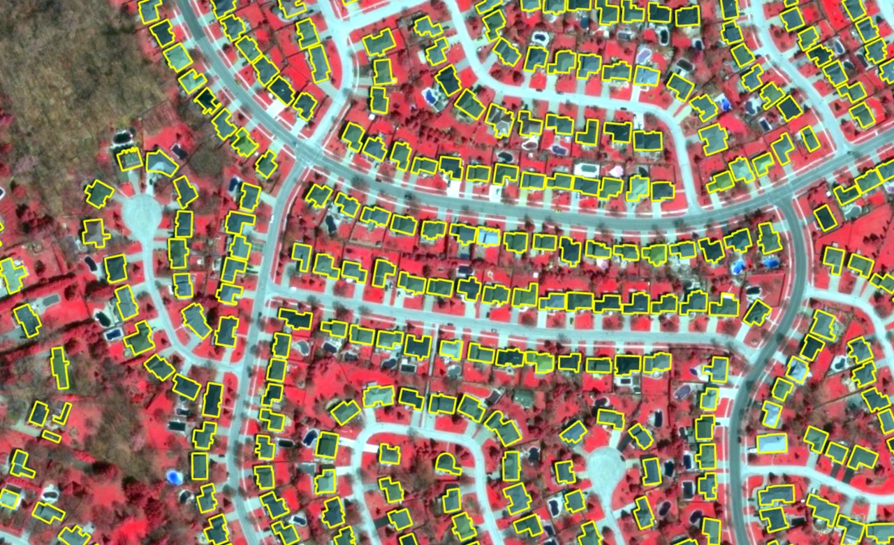
GIS Data Creation and Conversion: Digitizing and converting maps and spatial data from various formats into GIS-ready datasets.
GIS Mapping and Visualization: Creating detailed maps and visualizations that provide insightful geographical representations.
Spatial Analysis: Using advanced spatial analysis techniques to analyze trends, patterns, and relationships within your data.
3D GIS Modeling: Developing three-dimensional models for urban planning, infrastructure, and asset management.
Asset Mapping and Management: Efficiently managing infrastructure and assets through real-time location-based data solutions.
Remote Sensing: Using satellite and aerial imagery to extract meaningful data and provide comprehensive analysis.
GIS Application Development: Developing custom GIS applications and tools that fit your specific business requirements.
Land Use and Urban Planning: Supporting land use planning and management with spatial data integration and analysis.
By leveraging our expertise in GIS, we can assist you in making informed decisions, optimizing workflows,
and providing spatial data solutions that add significant value to your projects.