

Network planning activities evolve with the proper evolution of the network, the services, the technologies, the market and the regulatory environment. These evolutions imply a wider set of options to implement a network than in the past and as a consequence, the importance of careful planning and analysis for alternatives have larger impact on the network capabilities today in order to assure the needed capacities, the associated quality of service and the required investments.
As networks become mission-critical for business functions, design decisions made by IT professionals can have far-reaching implications. A network with a well-planned design will perform better. It will be more secure and resilient and easier to troubleshoot, and it will scale easily and adapt to future technologies.
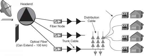
HFC is a hierarchical network design. Each headend includes fiber receiver/transmitter pairs that are connected through long strands of fiber to a remote fiber node. A remote fiber node converts received downstream optical signals to electrical signals and puts them onto the attached coaxial cable.
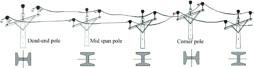
Pole loading analysis is the physical examination of a poll before the loading process.A pole loading analysis is needed to make sure that everyone out there meets protection measures and also the pole will be able to take the load of the new attachments and advancements
Permit drawings are an integral part of the construction process.These drawings are often used as the basis for a permit application.
We have expertees in As-built drawings. As-built drawings are drawings that show all the minor and major modifications made by the contractor to the original drawing to provide an exact rendering of the project. The preparation and use of as-built drawings come into play after the initial phase of the project.
A Geographic Information System (GIS Software) is designed to store, retrieve, manage, display, and analyze all types of geographic and spatial data. GIS software lets you produce maps and other graphic displays of geographic information for analysis and presentation.
We work on Smallworld, SpatialNet, Magellan, Microstation-V8i, BST/CAD, ARAMIS-(G-Tech),AutoCAD, NexusWorx, ESRI - ArcGIS, ArcMap, Fiber Manage, QGIS, 3GIS, Mapinfo, NDS, Frogs like GIS platforms.